Explore the Radnor Forest
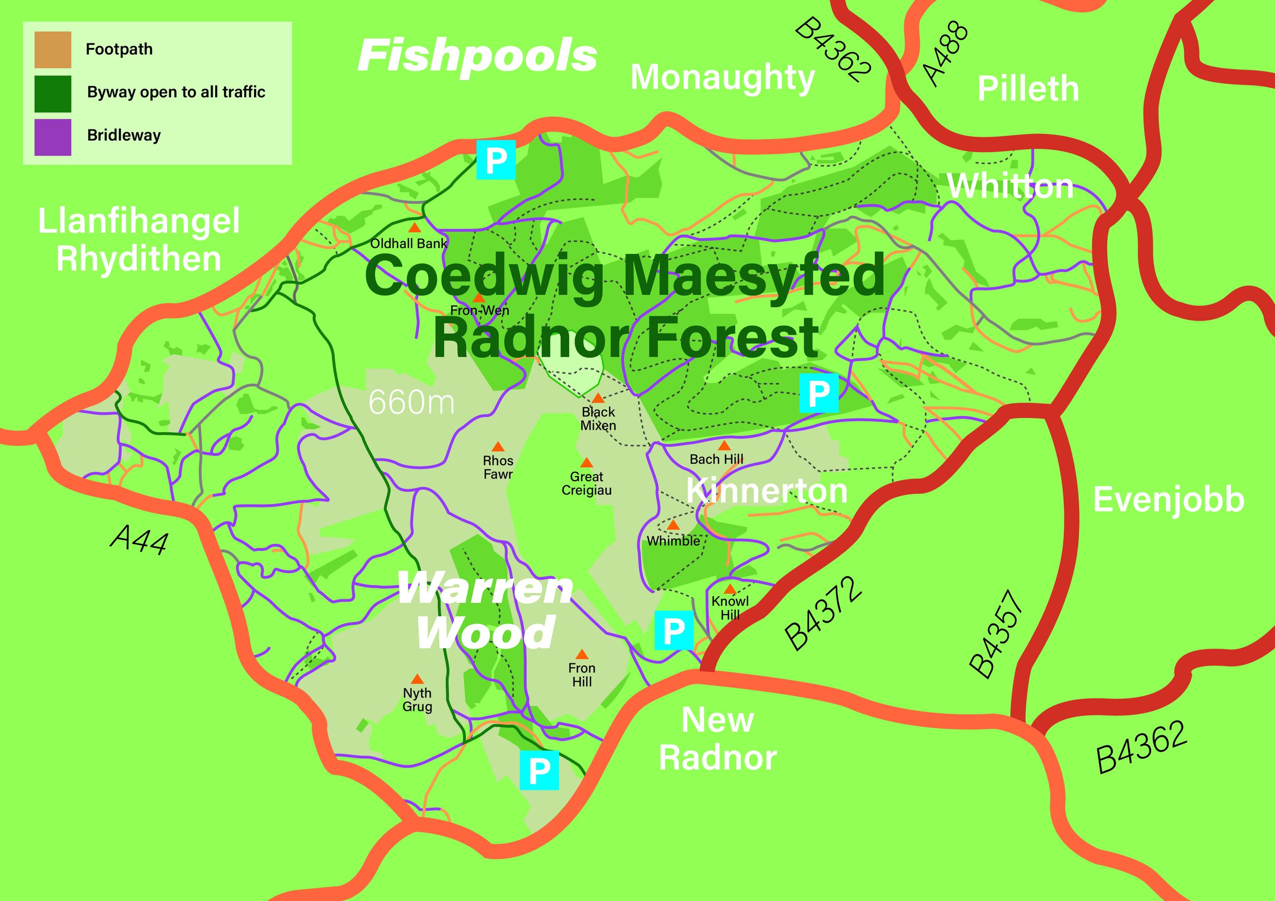
RIGHTS OF WAY
For generations the historic area of the Radnor Forest has had rights for people to use it and cross it.
It has Common Land rights, Open Access Land and Public Rights of Way.
It is crossed by many Public Rights of Way which are used and enjoyed by local people and visitors alike. The main categories in use in this area are :
Public Footpaths - a rights of way on foot only,
Public Bridleway - a right of way on foot, horseback or leading a horse. In some cases there is a right to drive animals [a drift way]
Byway Open to All Traffic [BOAT] a right of way for vehicles but a route which is mainly for the purposes for which public footpaths and bridleways are used.
Carriageway - over which there are footpath and bridleway rights and a right to pass with a vehicle.
Many of these are not tarmacked, some are stoned and others just cross fields. The historic Drovers Roads are a feature of the local area with their distinctive clumps of Scots Pines waymarks along the routes.
Walking & Running
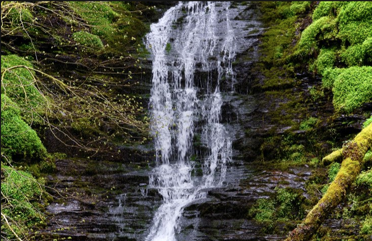
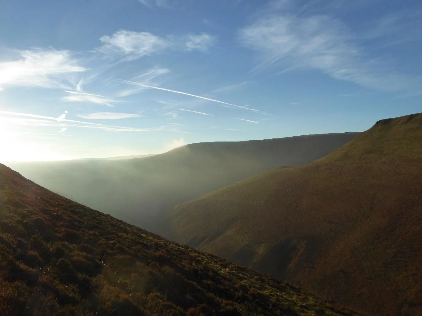
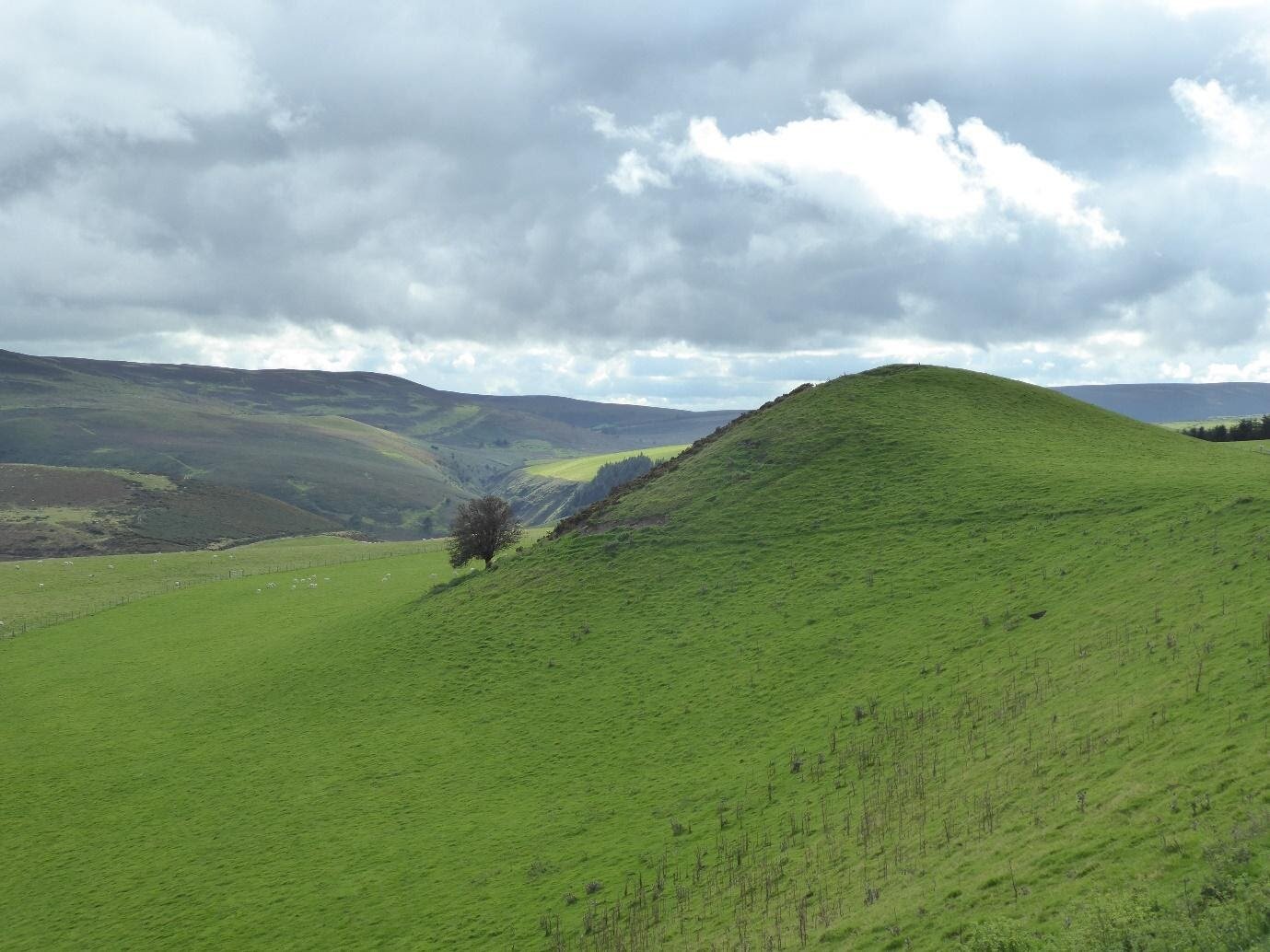
Walking out from the village of New Radnor on a circular walk around the Radnor Forest always makes a welcome break from the Brecon Beacons, just to the south, giving a totally different geological and topological vista. Getting up to the nearly 2000 feet high Whimble at the early stage of the walk ensures a brilliant cardiovascular workout. After this it is mostly plateau and downhill. The New Radnor Forest area is only partially wooded. There are wonderful pine-smelling tracks through the forest and there is a very good chance you will see a small herd of muntjac deer. Emerging from the forest into big skies and deep ravines. For the return journey it is all a nice gradual descent. The wonderfully named Water-break-its-neck is a must-stop-off; a stunning waterfall at the end of a deep gorge. It was a destination for day trip for visitors to Llandrindod Wells back in the days when it was a wealthy spa town in the 19th century, when they would have been taxied out to there by pony cab. And then back to the lovely little village of New Radnor, where you can fully refresh for you home journey home.
Horse Riding
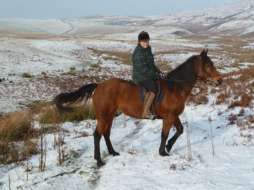
Riders will be pleased to learn that the Radnor Forest is hub, where several well-marked bridleways converge, taking the rider from any direction to the high points from where they can enjoy not only panoramic views but also tranquillity. Several trekking companies use these routes.
Cycling
One of the best ways to explore the Radnor Forest is on a bicycle. There are many trails to follow and these are described in detail, with maps, on several dedicated websites. They vary from easy to strenuous, according to distance and terrain. Most start from Mutton Dingle in New Radnor, Water-breaks-its-Neck or Fishpools near Bleddfa on N.R.W. managed forestry land, all of which have free car parking available.
Motorbikes

The Radnor Forest and surrounding hills are an area favoured by motorcycle trailriders, who use the Byways Open to All Traffic (BOATs) to enjoy the beautiful scenery these ancient rights of way afford whilst respecting the landscape itself, and indeed other users. And traveling on the metalled roads between the various BOATs that criss-cross Radnorshire, trailriders bring useful custom of the shops, cafes, hotels and filling stations in our local towns and villages.
About the area
Geology
This area is currently being mapped by the British Geological Survey for the first time since the mid nineteenth century! Some of the exposed strata around Harley Dingle and Whinyard Rocks show rocks dating back 425 million years to the late Silurian age.
Archaeology
One of the most exciting things about the Radnor Forest is the amount of unexplored or undiscovered archaeological features that it holds. There are many Bronze Age Round Barrows on the tops, along with several ring cairns, and there is quite a bit of evidence of prehistoric settlement hut circle platforms. It is thought that the area was also mined.
Vegetation
An abundance of diverse vegetation can be found all over the Radnor Forest, and one large expanse is a protected SSSI which is home to the rare Saxifrage, amongst other plants. Elsewhere on the summit you’ll find heather, crowberry and whimberry (bilberry) amongst the grasses – cottongrass, purple moor-grass, and sedges – mosses and lichens. Thanks to light grazing, the absence of fires and the presence of peat pools, these plants all thrive.

Birds & Wildlife
Thanks to the tranquillity and remoteness of this special place, the birds and animals share a rare relatively undisturbed paradise. If you’re exploring thoroughly, you’re likely to see Buzzards, Red Kites, Peregrine Falcons, Goshawks, Merlin, Red Grouse, Curlews, Snipe, Tree Pippets, Whinchats, Stonechats, Wheatears, Dippers and various owls.
Apart from the usual deer, foxes, rabbits, hares and badgers, if you follow a water course you might be lucky enough to spot an otter.

Mythology
Legend has it that St Michael the Archangel fought a war in heaven against Lucifer and is often portrayed defeating the Devil, represented as a dragon at his feet. There are ten churches in Radnorshire dedicated to St Michael, five of which surround the Radnor Fforest: Llanfihangel Nant Melan, Llanfihangel Cefnllys, Llanfihangel Rhydithon, Llanfihangel Discoed and Llanfihangel Cascob
The last dragon in Wales is said to be sleeping in the Radnor Forest, and the churches are there to contain the beast and protect us all. The dragon must not be disturbed!